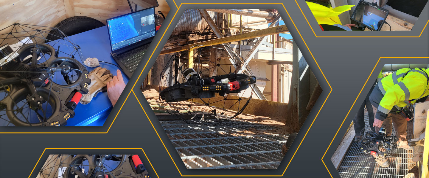
Drone Inspection Services for Confined Spaces
Hux Safety Solutions is proud to offer confined space drone inspection services as part of our capabilities. This innovative approach to confined space inspection and first response emergency situations increases safety for your personnel and staff by expanding areas of inspection, reducing time, and providing real-time situational awareness. Utilizing drone services for confined space inspection saves you time and money, increases safety, and produces high-quality data on-site. Our team is ASIPP trained & FCC part 107 licensed.
•LiDAR • 4K Camera 0.18 mm/px resolution • Thermal Imaging • Oblique/Dust-Proof 16K Lumen Lighting
SLAM-Based Stabilization
3D Live
Map
3D
Reporting
3D Surveying
Solution
Thermal
Imaging
FlyAware™
SLAM Engine
Key Features of Hux Drone Services
SLAM-Based Stabilization. Stone-still stability. No matter the conditions.
The all-new SLAM-based stabilization algorithm catches the tiniest unpredictable movements of the drone and instructs the flight controller to compensate for it. This allows for the drone to float in the air still as a stone even in the toughest conditions.
3D Live Map. Flawless locational awareness.
The embedded LiDAR constantly scans the surroundings to build a high-density point cloud map. This map is displayed instantly in the Cockpit App, empowering pilots with exceptional locational awareness. A real-time 3D view of the drone’s trajectory and environment provides crucial data.
3D Reporting. Understand where to focus your maintenance efforts.
From data capture to decision making, Inspector 4.0 and Elios 3 work hand in hand to provide operational continuity, boosting your efficiency through every step of the inspection process.
3D Surveying Solution. Survey-grade point clouds.
Thanks to an integration with GeoSLAMs software suite, Elios 3’s LiDAR data can be processed to build survey-grade 3D models of your asset enabling surveyors to map the truly inaccessible.
Thermal Imaging
When it comes to visual inspection, data is what matters. So, we have a thermal and 4K camera side by side providing multiple data sets in real-time and reviewable after the flight.
FlyAware™ is the unique combination of computer vision, LiDAR technology, and a powerful NVidia graphic engine. Acting as a centimeter-accurate indoor GPS, it builds real-time 3D maps enabling the drone to sense its surroundings instantaneously. Today, Flyaware™ allows for groundbreaking stability and highly accurate locational awareness. Tomorrow, it is the promise of complex confined space inspections performed with full autonomy.